The
Town House Trail runs from the village of Strafford near the Town House
to the highest point on Rt 132 on O'neill Road and is represented in 2
maps.
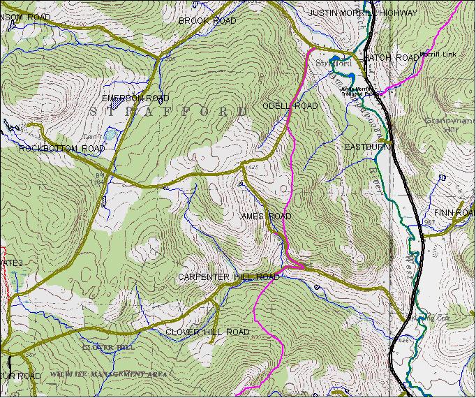
Map 1 covers from Stafford to Carpenter Hill Road
Map 2 covers from Carpenter Hill Road to Rt 132.
Map 1
Town House Trail -Strafford to Carpenter Hill Road
Following
Odell Road from Strafford village the trail climbs gradually then turns
left off the road following an old snow machine trail to the crest of
the ridge where enters the saddle off the field. Following the gully down the logging roads to Ame's road and down the hill to Carpenter
Hill Road. At this point go right and follow Carpenter Hill road only a few hundred feet to the yellow markers on the left . The trail goes down the bank and across the brook. Parking is possible near this sign and at the start of the trail behind the Strafford Town House. Where the trail follows Ames and Carpenter Hill roads there are no yellow markers. Take a copy of the map if you can. It goes only a short ways on Ames Road .
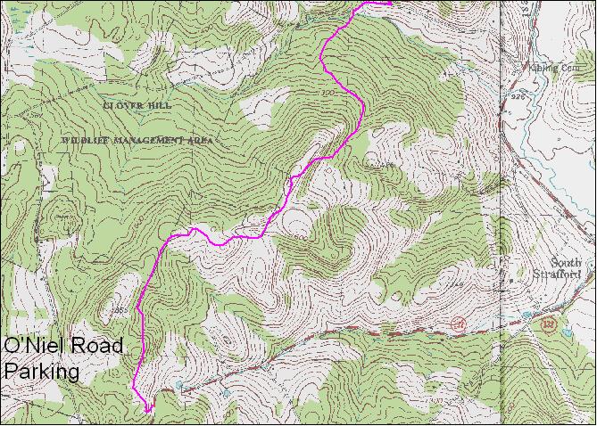
Map 2
Town House Trail - Carpenter Hill Road to Rt 132
Cross the brook paralleling the road and follow the yellow markers .25 miles through the woods to the VAST trail junction . Continue on the VAST trail and watch for a sign on the right at which point you leave the VAST trail and climb up to open fields on the ridge line and some exceptional views. Then beyond the clearings traverse the hillside beside the Clover Hill Wildlife Management Area to Rt 132. 3 miles. There is summer parking on Carpenter Hill Road and on O'Neil road off rt 132. A shorter loop can be hiked by starting from O'Neil Road access and following the trail over the rise, then along next to Clover Hill Wildlife Management Area to the fields on the ridge line where there is a large log landing. Leave the trail and follow the landing access road down to Rt132 via Blanchard Road and a short walk back up Rt 132 to O'Neil.