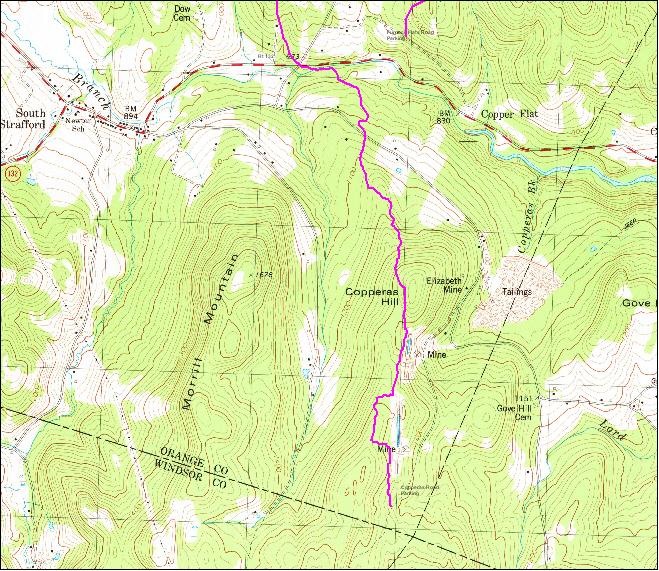
The Cross Town Trail runs from the highest point on Old City Falls Road to the Sharon town line in 4 maps with a length of over 12 miles. Follow the old Copperas Road leading from the south end to connect to the Norwich Gile Mountain trails and beyond.
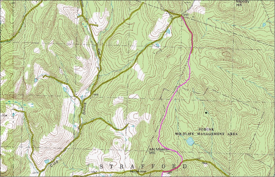
Map 3 covers the PWMA trail from Old City Falls road through the Churchill tree farm and Podunk Wildlife Management Area (PWMA) to Pennock Road .
Map 4
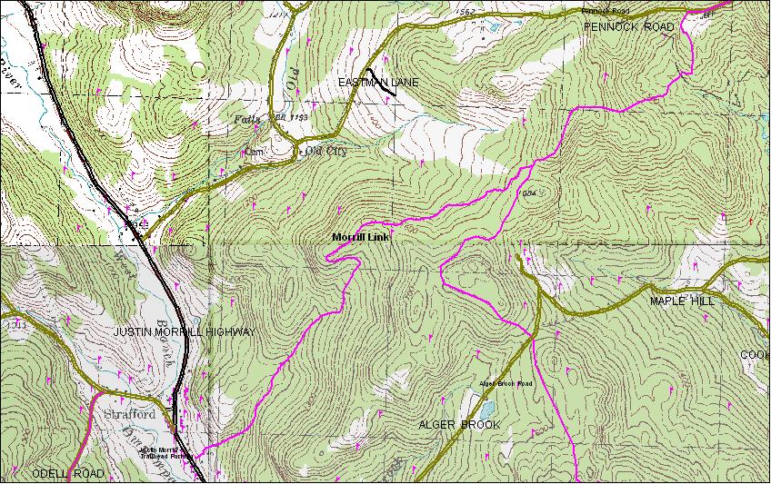
covers from Pennock Road to Alger Brook Road (Pennock trail) and the new Morrill Link to the upper village.
Map 5
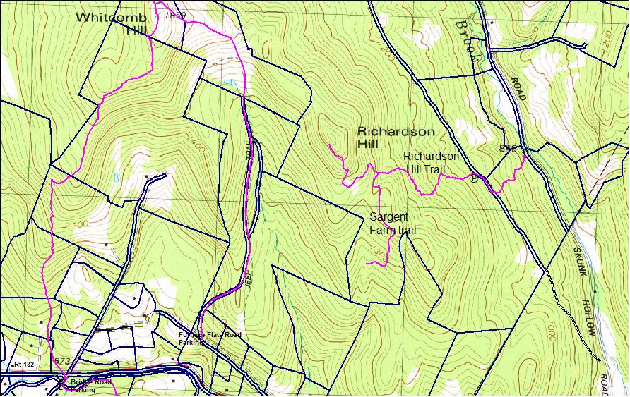
covers from Alger Brook Road to Rt 132 (Alger trail and Egg rock trail) and Richarson Trails
Map 6
covers from Mine Road to the Sharon town line.
Map 3 Old City Falls to Pennock Road.
Start at the cross roads at the highest point on Old City Falls Road. Follow (east) down the gated Churchill Tree Farm access road, straight through the landing to the road on the opposite side. Then watch for the flags where the trail leaves the road to the right, The yellow flags will lead you to the trail through the PWMA where there are old foundations and stone walls where it supported several farms. The southern portion follows the VAST route. At Pennock road go right about 1/4 mile to a clearing on the left. The trail continues south near the old foundation on the edge of the clearing. Old City Falls Road to Pennock Road is 2.3 miles.
Going north on the VAST section watch for 2 right turns where the trail branches off to the right.
Cross Rivendell Trail connection
You can continue north on the Cross Rivendell Trail (CRT) or connect coming south from the Cross Rivendell Trail by following the Moody Swamp road just over 2 miles.
Going north on the Crosstown Trail follow Moody Swamp road. Watch for the small CRT signs on the right once you find you're following the Old City brook on the right. Here you can take the CRT either east or west.
Coming from either direction on the CRT follow Moody Swamp Road East to the end on Old City Falls Road and beginning of the Crosstown Trail.
Cross Town Trail -Alger Brook north to Pennock Road
Map 5
Cross Town Trail- Alger Brook to Rt 132, Richardson trails
From Alger brook south there's little climbing to top of Whitcomb hill about 1.3 miles. Excellent views. From here the Crosstown trail goes south to rt 132, 2 miles. This is Egg Rock Trail. Look for the big boulder on the ridge. Alternately down to Furnace Flats access point and parking. Summit of Whitcomb Hill to 132 is 1.4 miles, Alger Brook to Rt 132 at Furnace Flats 3 miles. Views from Whitcomb Hill are the best on the trail and recent clearing has opened vistas to the west and the Green Mountain chain.
Map 6
Cross Town Trail - Mine Road to Sharon Line
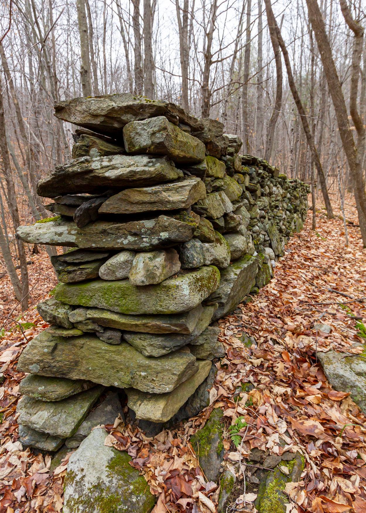
Sargent Farm Trail
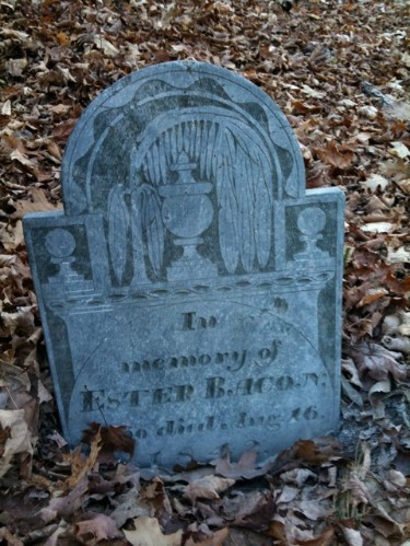
This trail branches off Richardson Hill trail and goes down the south face to an old farm with some of the most impressive stonework on any local abandoned farm. An early record shows the Sargent family owning this farm and accessing it from Rt 132. These settlers must have had some Incan ancestors given their stonework.
Below is a sample of the Sargent farm stonework. Photo credit to Will Cooney.
Please respect these properties. The generosity of the individual land owners makes this resource possible.